 The Early History of Prospect Hill Park
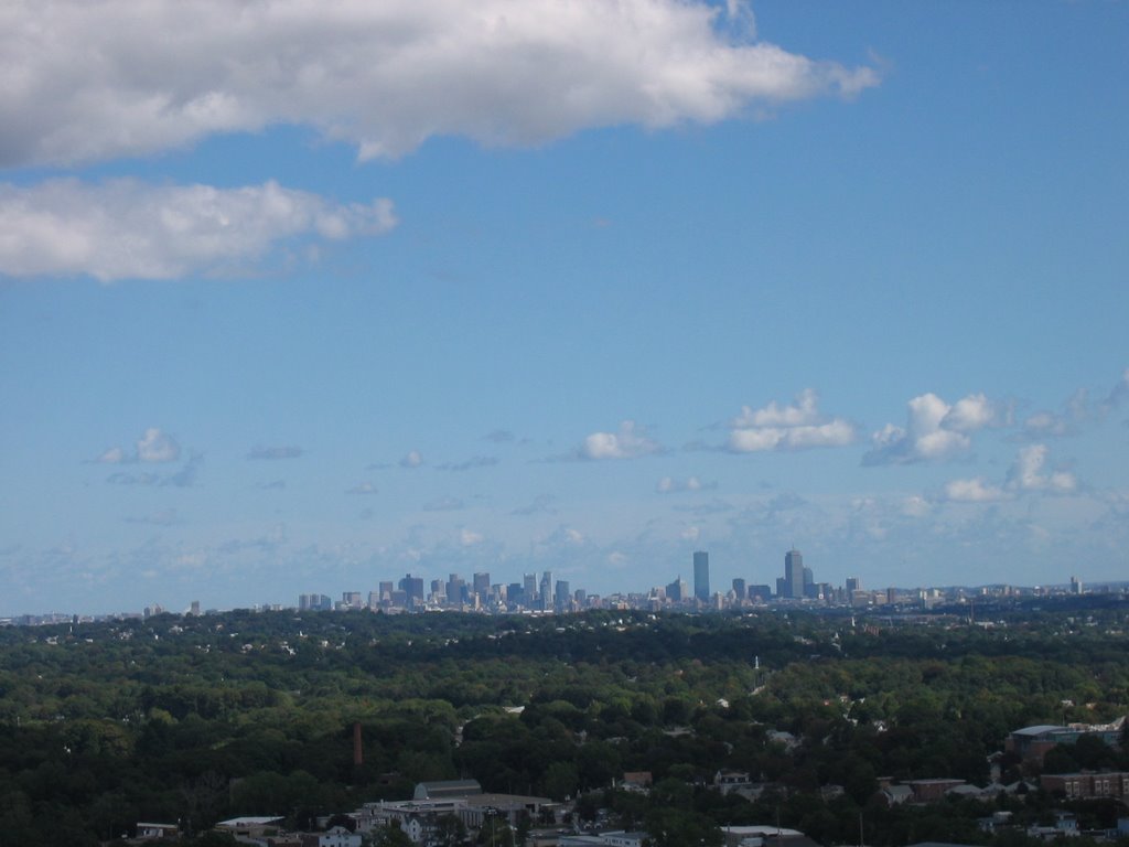
This Photo was taken from the very top of what is called Boston Rock because of the view. This was quite the surprise for I had never seen it nor did I know it was even here. and I was born and raised in this area, wonders never cease. I have gathered some information about this little bit of history for anyone interested. I also set up a link with the Title Prospect Hill Park at the top of the post where there is all the information about the City of Waltham Ma for all to check out.
The life history of humanity has proved nothing more clearly than that crowded populations, if they would live in health and happiness, must have space for air, for light, for exercise, for rest, and for the enjoyment of that peaceful beauty of nature which, because it is the opposite of the noisy ugliness of towns, is so wonderfully refreshing to the tired souls of townspeople.
Mr. Charles Eliot, Landscape Architect for the Metropolitan Park Commission, Boston 1893.
In Waltham, to the north-westward of the centre of the city's population, lies the noble eminence of Prospect Hill, the greatest elevation in the neighborhood of Boston after the Blue Hill.
Created in 1893, Prospect Hill Park covers 250 acres, entirely within the City of Waltham. At this size, it is a significant open space, and "perhaps the largest municipally-owned park inside the loop of Route 128." The park covers a ridge which features two significant peaks. At 485 feet above sea level, the higher of the two is the second highest point in the vicinity of Boston, only the Great Blue Hill stands taller. This peak has been called Great Prospect, but is more often referred to as Big Prospect, while its smaller associate, which stands at 435 feet, is known as Little Prospect. Both peaks provide excellent views of the Boston basin.
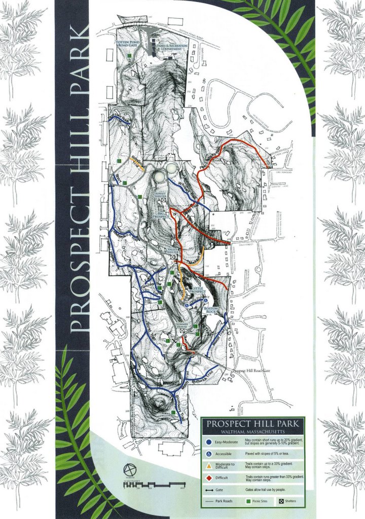 Check out this map click to enlarge
The Metropolitan Park Commissioners were Charles Francis Adams, Philip A. Chase, and William B. de las Casas. They hired Sylvester Baxter as a secretary interested in the subject and familiar with the ground to be covered, whose duty it would be also to collect documentary information along with Charles Eliot, an associate of Frederick Law Olmsted, as a professional landscape architect, to devise a practical scheme of development and prepare the maps, plans and report to explain it.
The Commissioners published their report in January of 1893. In it they stated their belief in the importance of a metropolitan park system: The provision of ample open spaces for public recreation and the promotion of public health is now universally regarded as an essential feature in the proper equipment of urban communities. In all parts of the civilized world the leading cities are recognizing this necessity. The younger cities are perceiving the wisdom of providing amply for the future in this respect by securing lands in suitable locations and in sufficient amount, to be developed with the growth of their population. The older cities, like London, Paris and Berlin, though long possessed of extensive reservations of this description, are to-day finding their amount of open spaces inadequate, and are taking measures for securing extensive areas in addition that will meet the needs of the future. This report reviewed the numerous suitable locations for parks within the metropolitan area, and included a map revealing both existing and proposed public open spaces. Among the proposed open spaces was a park which would have included both Prospect Hill and nearby Bear Hill. Despite their interest, the Metropolitan Park Commission chose not to involve themselves in the acquisition of Prospect Hill. This was in part due to the fact that Prospect and Bear Hills both lay entirely within the City of Waltham, and thus Waltham's own Park Commission, formed in 1892, was already making plans to acquire the land that would eventually form the park.
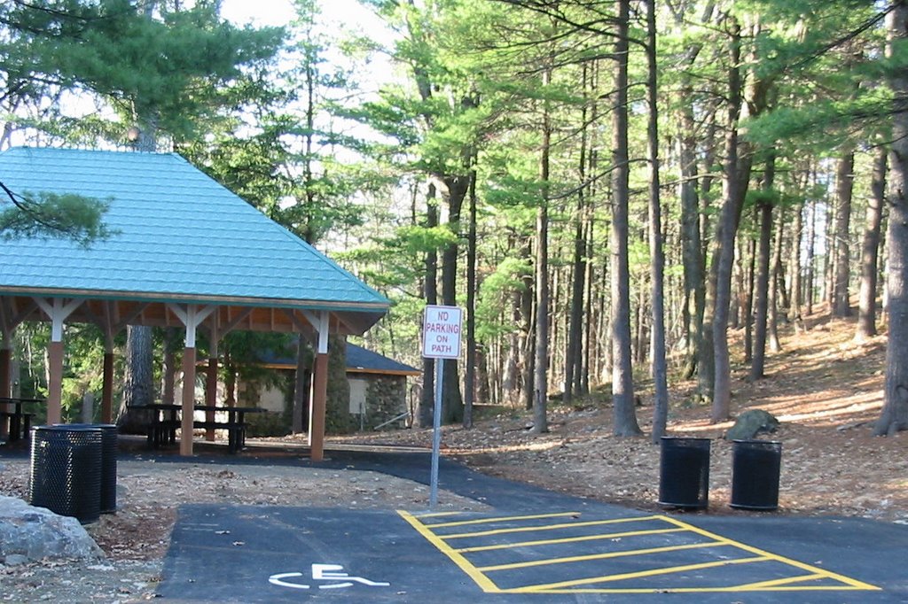 Picnic Area 1/2 way up the hill
1 comment:
Thanks for posting the lovely photos and interesting history of the park! I love the map pictured as well. Any idea where one would get a paper copy of such a map? I live near the park and it would be great to have a map of the trails to help me plan shorter and longer walks ahead of time. Thanks again for your great post!
-paula
Post a Comment